All about the parish council home page
parish council, home
Latest News
Free Food Caddy Liners
Oxfordshire Libraries
02
December 2025
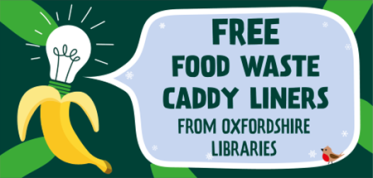
Collect a free roll of food waste caddy liners in December
Many households buy and eat more food over the festive period, and because of this, the amount of food waste collected goes up. Remember that food waste is not just wasted food, it also includes the inedible parts of the food we buy – peelings and bones as well as things like tea bags and coffee grounds.
As this time of year households often have more sprout peelings, turkey bones and potato peelings to recycle.
If you can’t home-compost your food waste, recycling it using the food waste collection service is the best thing to do with it.
To help you recycle your food waste over the festive period, you can pick up a free roll of food waste caddy liners from any Oxfordshire library in December (while stocks last).
See OCC Website for more details: https://www.oxfordshire.gov.uk/waste-and-recycling/household-waste/food-and-garden-waste#paragraph-19784